Three major wildfires burning near Spokane, Washington, caused authorities to declare a state of emergency and forced thousands of people to evacuate.
The Old Trails, Fairview and Autumn Lane fires have scorched over 7,700 acres with 0% containment as of 2:45 p.m. ET on Aug. 2, Benjamin Cossel – public information officer for the California Interagency Incident Management Team 7 – confirmed to USA TODAY. Cossel said that more than 600 structures have been destroyed by the fires, a number that he said is likely to rise. He added that Autumn Lane was the "fire of concern" for Aug. 2.
Washington Gov. Bob Ferguson declared a statewide emergency and burn ban on Aug. 1. Multiple areas of Spokane are under a Level 3 evacuation order, the highest level in the state. About 5,000 homes have been evacuated, according to the Associated Press.
"We urge residents of Spokane to heed evacuation orders and to stay alert to changing conditions and evacuations as they are rapidly changing," Courtney James, spokesperson for the Washington State Department of Natural Resources, told CBS News.
 A heatwave scorching the western US region has elevated the risk of hazardous fire conditions particularly in parts of Oregon and Washington, where low humidity and powerful winds have put officials on alert for wildfire spread.
 The sky outside is hazy orange, and my five-year-old son is screaming bloody murder. “Sorry, buddy, we have to stay inside,” I say. “It’s not safe to breathe out there.” I had told him we’d be going to the beach today. Something inside me tears a little as I wonder how many promises he’ll see similarly broken in the coming years.
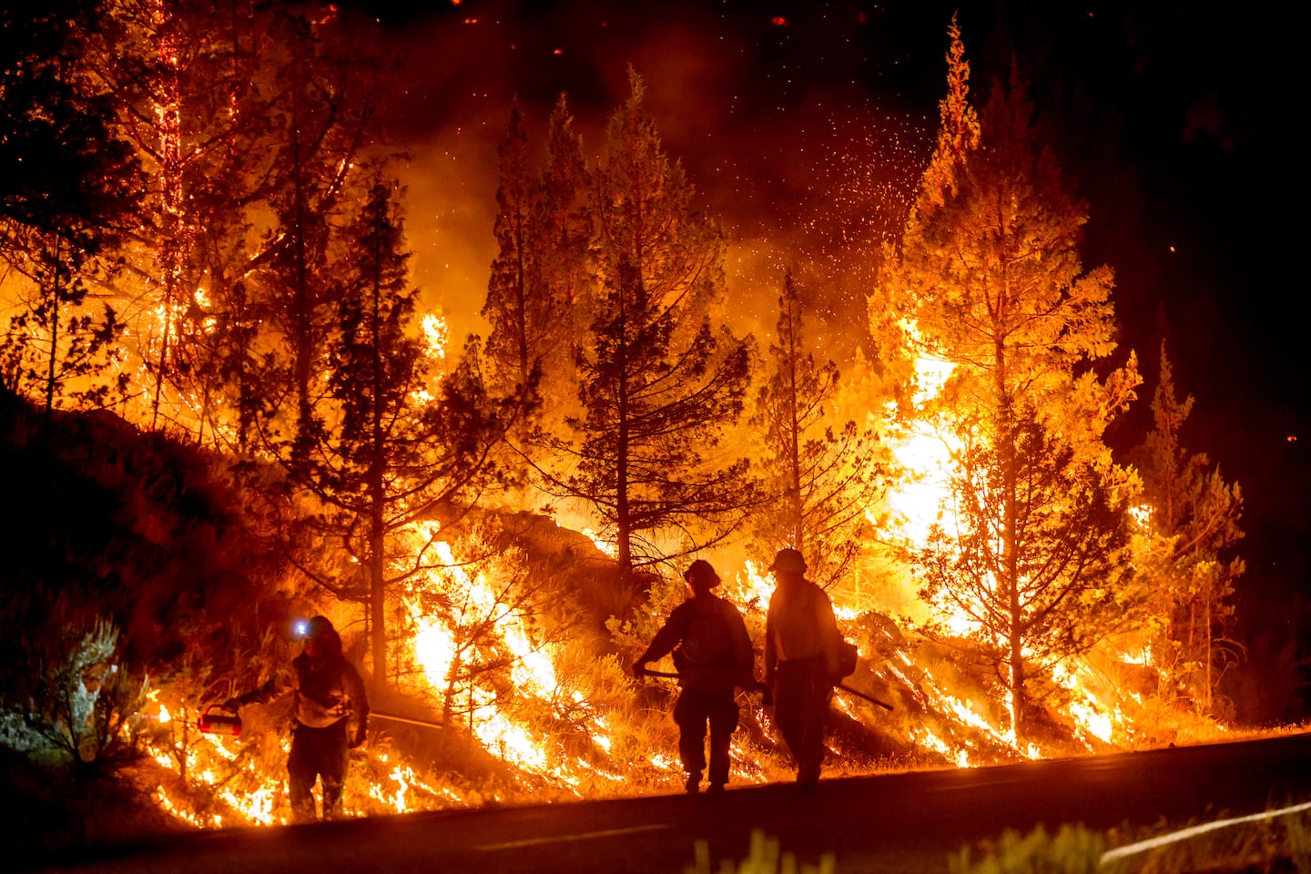 Large swaths of Central Oregon have become consumed by wildfire, with several blazes burning across the region simultaneously, forcing thousands to evacuate and further stretching the state’s limited firefighting resources.
 A tornado struck north-eastern Wisconsin on Monday, blackening the midday sky and sending workers sheltering in office basements as ferocious winds splintered homes, scattered twisted metal across a highway and knocked out power to more than 30,000 people.
 At least 40 million people were under extreme heat warnings across central and southern parts of the United States on Sunday as high temperatures and severe humidity gripped large swaths of the country for a second straight day.